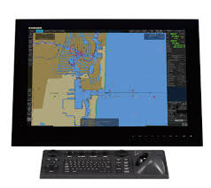
The Electronic Chart Display and Information System (ECDIS) is a computer-based navigation system used aboard ships to display and manage electronic navigational charts (ENCs) and other navigation-related information. ECDIS provides real-time information about the ship’s position, heading, speed, and surrounding environment by overlaying data from various sources onto electronic charts. These sources may include GPS, radar, Automatic Identification System (AIS), and depth sounders. ECDIS enhances navigational safety by offering features such as route planning, voyage optimization, collision avoidance, and alarms for potential hazards. It replaces traditional paper charts and reduces the risk of human error associated with manual chart interpretation. ECDIS is mandatory for certain types of vessels as per international maritime regulations and is considered a vital tool for modern maritime navigation, improving efficiency, accuracy, and situational awareness on the bridge.
If you need marine communication equipment, radio survey, service, repair, or installation, NAVITECHSOLUTION is here to help. Contact our team today.


